
Far Out Nevada
Angel Lake Climber
A great climb of about 3000 ft from the West Exit off I 80 in Wells to the beautiful alpine Angle Lake and Campground. The pavement is varied but very rideable. The steepest ramps are in the lower half. Don't miss it if you are out this way....on the way to somewhere else hopefully.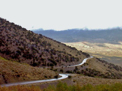 |
| From Far Out Nevada |
Route Map
Pony Express Century
In the middle of no single where. This route starts near Middlegate, NV at the Junction of Hwy 50 and 722. It is lonelier than the Lonekiest Road in America by far. Bring everything you need. There will be nothing until you reach Austin. Hot in the summer, cold in the winter and possibly windy at any time. The biggest climb is over Carrol Summit and smaller climbs over Railroad Pass and up to Austin. Now turn around and go back! Good eats and gas at Middlegate.
Route Map
Wheeler Peak Scenic Road
Starting at the Great Basin National Park Visitor Center in Baker, this is a long and steady climb up the only paved road in Nevada to exceed 10,000 feet in elevation. Traffic? Forget about it. This is a great ride with about 4,900 feet of climbing if you summit and then descend a short way to the campground. It can be hot and dry so bring plenty of water. Water is available at the visitor center and at Wheeler Peak Campground. Water is also available if you ride off the route to the Lehman Caves area and Lower Lehman Campground. 33 miles round trip.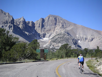
Route Map